2012
Harvested
Provided by
Type of resources
Available actions
Topics
Provided by
Years
Representation types
Update frequencies
status
Scale
Resolution
-
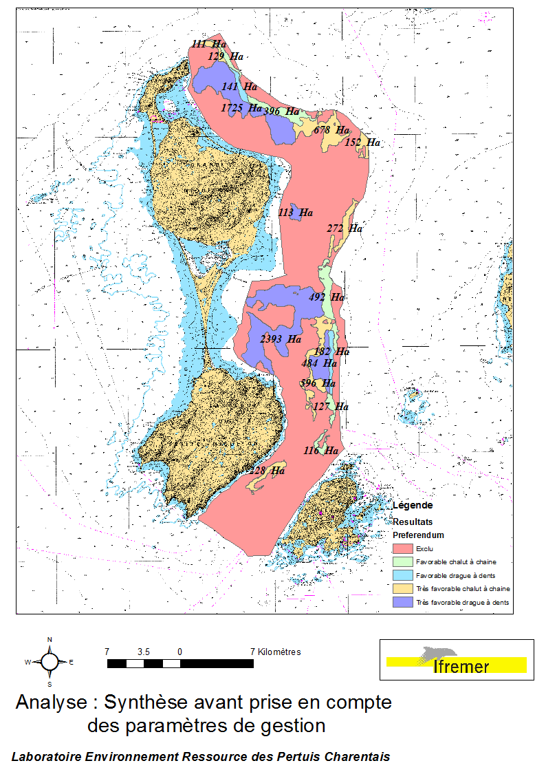
This data set was obtained during 2 ENVISION-IFREMER field campaigns carried out in 2007 and 2011, to sustain a R & D project aimed to develop pectinid aquaculture. This project was co-funded by the St Pierre et Miquelon public collectivity and ODEADOM. This represents a synthesis of spatial analysis based upon multi-criteria to assess future seeding and rearing areas for King scallop Placopecten magellanicus on the Eastern coast of Saint Pierre et Miquelon.
-
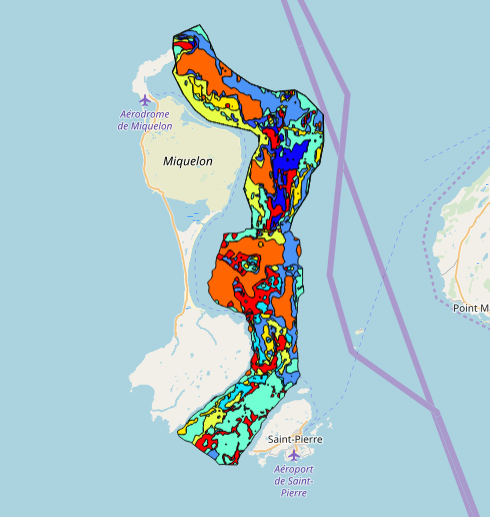
This data set was collected during 2 ENVISION-IFREMER field campaigns carried out in 2007 and 2011 to sustain a Pectinid aquaculture project. This was co-funded by ODEADOM and the public collectivity of Saint Pierre et Miquelon. This work aims to assess new seeding and rearing areas for the King scallop Placopecten magellanicus through a site selection process using the bottom type mapping data set obtained during the 2 ENVISION-IFREMER field campaigns. Furthermore, new estimates of potental scallop production is produced by this data treatment.
-
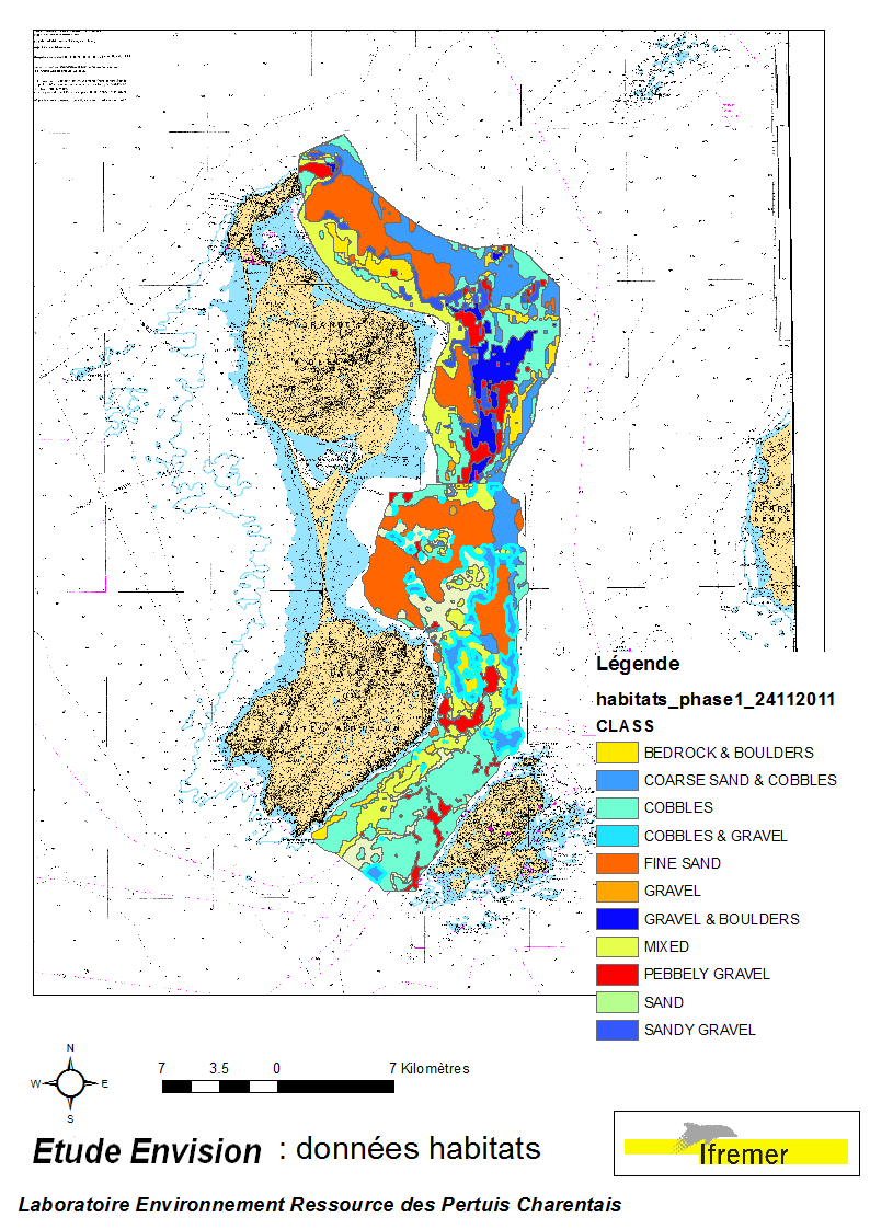
These data were collected during the 2007 and 2011 ENVISION-Ifremer campaigns to sustain a R & D project focusing on the Pectinid aquaculture development. This project was co-funded by the Saint Pierre et Miquelon public body and ODEADOM. This work aims to assess and select new potential rearing areas for the King scallop Placopecten magellanicus by using bottom type data resulting from 2 mapping campaigns carried out in 2007 and 2011 on the Eastern coast of Saint Pierre et Miquelon archipelago.
-
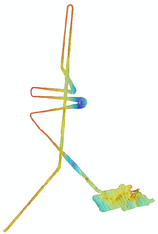
Bathymétrie de la zone du plateau de Saint-Pierre et Miquelon (SPMPLAC, 2011), au pas de 5 mètres. Le modèle bathymétrique est réalisé à l'aide des données de sondeur multifaisceau Simrad EM302 de la campagne SPMPLAC, acquises à proximité des îles. Objectif : couverture d'une zone de recherche de l'épave du Ravenel. Description de la campagne : SPMPLAC, R/V Le Suroît, 2011, https://doi.org/10.17600/11020060 La campagne est principalement dédiée au programme Extraplac avec l'objectif d'une cartographie de la marge et des grands fonds au large de Saint-Pierre et Miquelon. Toutefois, quelques heures d'opérations spécifiques ont été également réalisées à proximité des îles. Rapport associé : Campagne SPMPLAC, Levé cartographique aux abords de Saint-Pierre, groupe de projet Extraplac, 2012
-
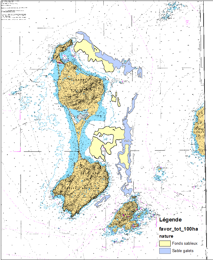
This data set was obtained during 2 ENVISION-IFREMER field campaigns carried out in 2007 and 2011 to sustain a Pectinid aquaculture project. This project was co-funded by ODEADOM and the public collectivity of Saint Pierre et Miquelon. Potential areas for further aquaculture exploitation and development on the Eastern coast of Saint Pierre et Miquelon.
 GeoSPM